Renhui Forum [Digital Empowerment] | Filip Biljecki: Urban informatics for sustainable and liveable cities

杨廷宝先生,字仁辉,是我国著名建筑学家和建筑教育家,东南大学建筑学科创立的一代宗师。2021年杨廷宝先生诞辰120周年之际,为传承和光扬先生的学术精神,东南大学建筑学院开设“仁辉讲堂”,长期延请国内外著名学者、建筑师举办讲座,弘扬学术,激励后学,推动中国建筑和建筑教育事业的蓬勃发展。
一直以来,建筑学学科在新技术的影响下不断发展。尤其是近几年数字技术、人工智能所带来的创新思维和应用,促使古老的建筑学直面机遇和挑战,加快转型,探索新的学科边界。为此,从今年开始,仁辉讲堂增设“数智赋能(Digital Empowerment)”系列,展现国内外最新成果。
本期仁辉讲堂,由新加坡国立大学(National University of Singapore)菲力普·比列茨基(Filip Biljecki)教授主讲,采取线上线下同步直播的方式开展。


  直播信息  

点击下方链接进入直播间地址

https://live.bilibili.com/22255700

Bilibili直播间ID 东南大学
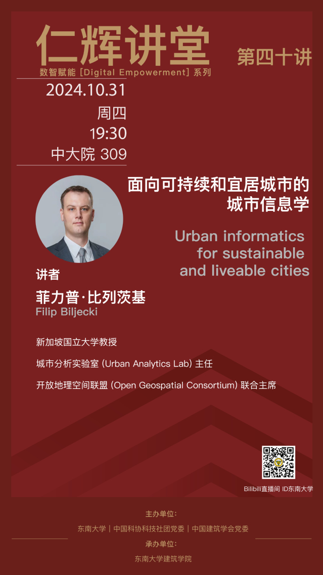

面向可持续和宜居城市的

城市信息学

Urban informatics for 

sustainable and liveable cities


主讲人:菲力普·比列茨基
 Filip Biljecki

本次演讲将介绍新加坡国立大学城市分析实验室在城市和地理空间建模方面的最新研究工作,重点在于理解新兴数据集的可用性以及通过众包获取城市信息。实验室主导了多项全面而紧密交织的研究,涵盖城市领域的整个地理空间过程:从数据获取和质量评估的改进,到开发新的应用场景并通过人工智能和分析挖掘数据价值。例如,该团队开发了全球首个针对城市可持续发展的开放屋顶注册表。这些新功能具有生成和分析城市形态高分辨率数据的潜力,并有助于开发评估和支持城市可持续发展的新工具。

The talk will present recent research efforts on urban and geospatial modelling at the NUS Urban Analytics Lab, which largely focuses on understanding the usability of emerging datasets and crowdsourcing urban information. The Lab spearheads a holistic and intertwined research agenda that covers the entire geospatial process in the urban sphere: from advancing means to acquire data and assess its quality to developing new use cases and unlocking value with AI & analytics. For example, the group has developed the first global open registry of rooftops for urban sustainability. Among other benefits, these new capabilities have the potential to generate and analyse high-resolution data of the urban form and contribute to developing novel instruments to assess and support urban sustainability.

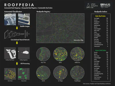
Roofpedia – Mapping Roofscapes with AI

Roofpedia is an open registry of sustainable roofscapes around the world. It uses deep convolutional neural network to detect sustainable roof typologies from satellite images. Footprints of buildings identified with solar panels or rooftop greenery are tagged automatically, and the results are visualized above for a score of cities.
Global Streetscapes

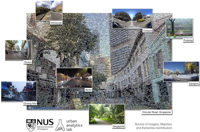
Global Streetscapes is a worldwide dataset of 10 million crowdsourced SVIs sampled from Mapillary and KartaView, covering 688 cities around the world, which account for about 10% of the world’s population, enriched with more than 300 attributes and has wide geographical, environmental, and temporal diversity. In addition, the project is supported with open-source code and documentation. It is a big open large-scale labelled street-level imagery dataset addressing various challenges on using street view imagery in urban sciences. A comprehensive paper about the project is published as a namesake article in the ISPRS Journal of Photogrammetry and Remote Sensing.

Global Building Morphology Indicators (GBMI)

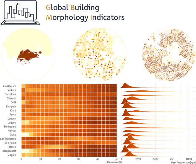
GBMI introduces a formalised, structured, modular, and extensible method to compute, manage, and disseminate urban indicators at a large scale and high resolution, while the precomputed dataset facilitates comparative studies. The theory and implementation traverse multiple scales: at the building level, both individual and contextual ones based on encircling buildings by multiple buffers, and aggregations at several hierarchical administrative levels and at multiple grids. Our open dataset, comprising billions of records on a growing scope of urban areas worldwide, is the most comprehensive instance of morphological data parametrising the individual building stock, supporting studies in urban analytics and a range of disciplines.


讲者简介


图片

菲力普·比列茨基是新加坡国立大学(NUS)建筑系教授,NUS城市分析实验室(Urban Analytics Lab)主任, 开放地理空间联盟(Open Geospatial Consortium)联合主席。他的研究和教学融合了地理信息、地理空间技术和城市数据科学,支持数字孪生和数据驱动的城市规划。他发表了120多篇同行评审文章,并多次获得新加坡国立大学的教学和研究奖项。他在全球100多所大学和组织发表过演讲。他指导了大批学生,并帮助他们在顶级期刊上发表文章,并进入世界顶尖的大学和组织工作。

Dr Filip Biljecki is an assistant professor at the National University of Singapore and the founder of the NUS Urban Analytics Lab. He holds a MSc and PhD degree from the Delft University of Technology in the Netherlands. Filip’s research and teaching are converging Geomatic engineering, geospatial technologies, and urban data science to support digital twins and data-driven urban planning. He has published more than 120 peer-reviewed articles. At NUS he has been awarded for teaching and research multiple times, and has supervised dozens of students leading them to publications in leading journals and placements at top universities and organisations. He delivered talks at more than 100 universities and organisations worldwide, including MIT, Stanford, Harvard, Berkeley, Peking, Tsinghua, University of Tokyo, Hong Kong University, Seoul National University, and ETH Zurich.


关闭